Hiking to Pico de Mijas is one of the most rewarding things that you can do in Sierra de Mijas. Pico de Mijas is a medium to difficult hike, and it’s worth it for the beautiful views from the top. The hike to Pico de Mijas is a day’s trip from Malaga, taking at least 6 hours, plus the time you spend on the top.
Sierra de Mijas Mountain Range

Pico de Mijas is the highest point of the Sierra de Mijas Mountain Range, sitting at 1,150 meters above the sea level.
Sierra de Mijas is part of the Cordillera Betica, one of the main systems of mountain ranges in Spain, that stretches between western Andalucia, Murcia, Valencia and the south of Castilla-La Mancha. The Rock of Gibraltar and the Sierra Nevada mountains are part of the Cordillera Betica.
Sierra de Mijas divides Costa del Sol from the Guadalhorce Valley, and it is mainly composed of marble and limestone. There are quite a few hiking trails in Sierra de Mijas, and one of the hardest leads to Pico de Mijas, its peak.
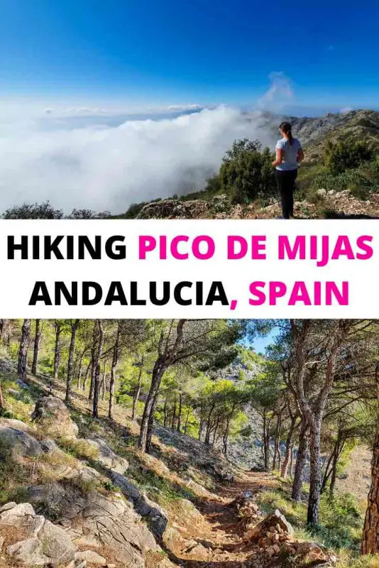
When Hiking to Pico de Mijas you will pass by types of vegetation, from pine wood forests to wild olive trees, many different types of herbs (thyme, rosemary, fennel, lavender, marjoram) and surprisingly, orchids.
Very often, you can meet mountain goats when you hike on the trails of Sierra de Mijas, especially around the rocky areas. Towards the top, where the vegetation rarefies, you can admire golden and booted eagles, kestrels and genets.
What to pack for a day hike to Pico Mijas
When you are hiking to Pico de Mijas, there are a few things that you should bring with you:
- A small backpack
- Good grip shoes, boots or hiking trainers. The terrain is rocky and slippery, you need proper hiking shoes when you are doing this hike
- Wear long pants, even if the weather is nice. There are many spiky bushes on the trail
- At least 2 litres of water. I drank my entire bottle before even reaching the top
- A hat – there are many parts of this trail that have no shade at all
- Sunscreen
- Snacks to boost your energy on the way and sandwiches to eat at the top – remember to leave no trace behind and bring the trash back with you off the mountain
- Trekking poles are very useful and recommended, but not necessary
- A fully charged mobile phone, in case of emergency. Most of the trail has signal coverage
Hiking Pico de Mijas

Hiking to Pico de Mijas is not a walk in the park, and you should be relatively fit if you want to attempt it. I struggled myself quite a bit to reach the top. You can pick up a map of the hike at the Touristic Office in Mijas Pueblo.
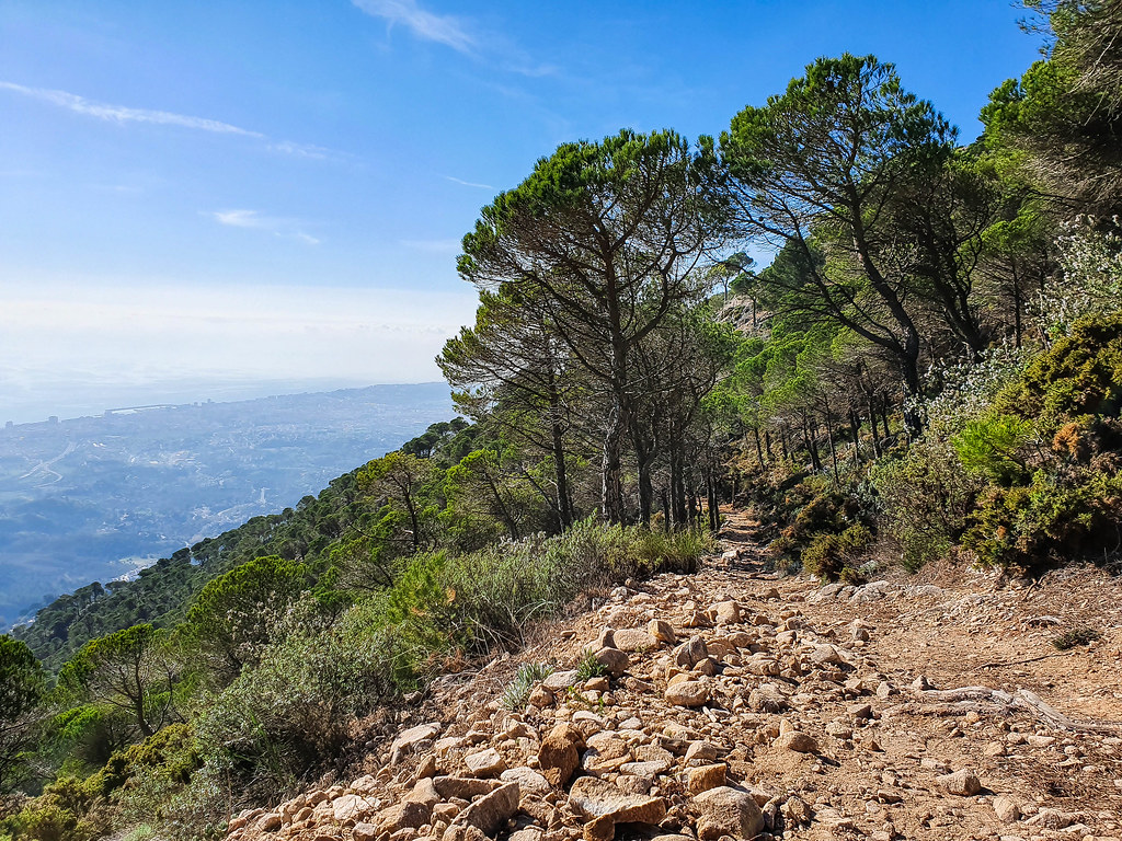
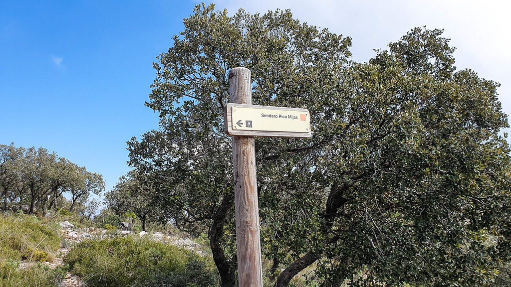
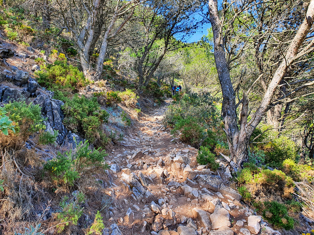
The trail starts in the upper part of Mijas Pueblo, and steeply climbs up to Eremita del Calvario, the small chapel which is only open during Easter. Here is a nice place to stop and admire the panorama of Mijas Pueblo, and the sea down below. You might already be feeling tired, but this is just the beginning. The trail splits just before Eremita del Calvario, going up quite steep, uneven, and in a zig zag. The path is rocky and dusty, with loose stones. Follow the orange marks and the signs towards “Pico Mijas”. At some point, the trail opens up to a stunning panorama behind you. Make sure that you stop and take in the views.
After another section through the pine forest, the trail reaches a dusty road. This is a great place to stop and rest, maybe have some snacks and take some photos. The views are getting better and better.

The path then continues up through the forest, but only for another 10 – 15 minutes or so. After that the vegetation becomes smaller and smaller, and there are no more shaded areas until the top. Soon you will reach a junction where you will turn left. You will think there’s not much left, but a sign will tell you that you are another one hour away from the top.
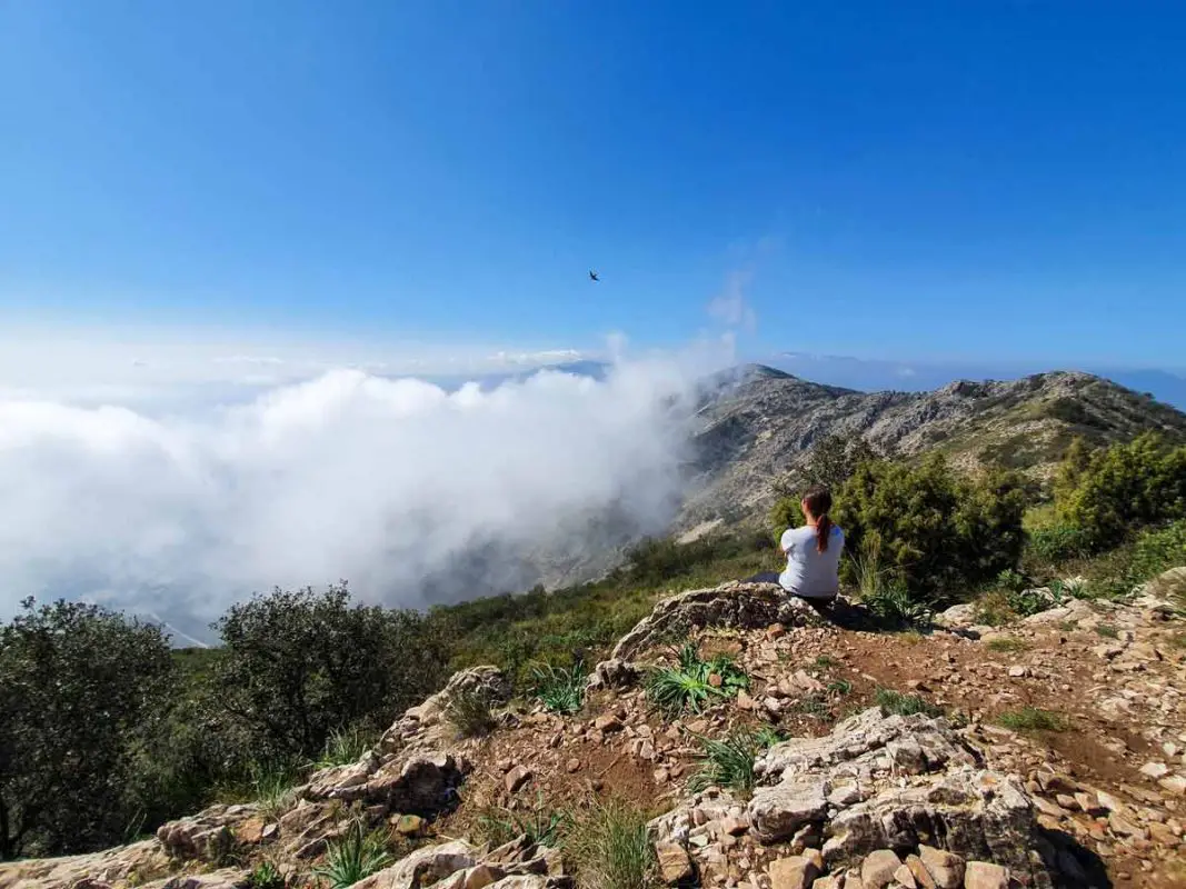
Crossing the ridge, you will find yourself on the other side of the mountain. Don’t worry if you are afraid of heights, there are no sudden drops and the edges are not steep. It’s not the kind of ridge that gives you a vertigo.

Another 300 meters or so, and you can see “La Bola”, the meteorological ball from the peak of the mountain. It might seem very high and far away, but it’s not. The zig zag path continues up the side of the mountains and after more or less half an hour, you will reach the top.
Here will be the last bit of effort – the final path to “La Bola” is very steep and slippery, but it’s not very long.

The views from the top are breathtaking! On a clear day you can see the mountains of Morocco and Gibraltar to the right, and Malaga, La Maroma and Sierra Nevada mountain ranges to the left. You can even spot the airplanes landing or taking off at Malaga Airport.
Take your time and enjoy the peak, you’ve deserved it after climbing such a steep path!
Map of Pico de Mijas

Logistics:
Length: 14,5 kilometres / 9.2 miles
Peak: 1,150 meters high
Elevation: 720 meters
Approximate time: 6 hours return
Difficulty: Moderate – High
Markings: Orange path, very well marked through paint and signs
How to Get to Pico de Mijas
The starting point of the Pico de Mijas hike is in Mijas Pueblo, which is very easy accessible by car and by public transport.
By car:
If you are renting a car in Malaga, follow the A7 motorway towards Algeciras. When the motorway splits into A7 and AP7 (toll road), take the latter and exit at the first junction – it’s free. At the roundabout at the end of the slipway, take the very well signed exit towards Mijas Pueblo. Drive on the A368 for another 5 minutes or so and you will arrive at your destination.
By public transport:
If you are relying on public transport, depending on the season, there are two options to reach Mijas Pueblo. The M112 connects Malaga with Mijas Pueblo but it doesn’t run very frequently in winter. Alternatively, take the C1 train to Fuengirola (this train runs every 20 minutes), and from there the local M122 bus towards Mijas Pueblo.
Where to Park When You Climb Pico de Mijas
The public parking in Mijas Pueblo costs 1 euro a day and it is the best place to leave your car when you plan on hiking Pico de Mijas. Some people park on the upper road, where the trail starts, but I wouldn’t recommend it because it’s not very safe. Better to do a bit more climbing to reach the start of the trail, rather than end up with the car in a ditch.
With 10 levels, there is always space in the public multi storey car park in Mijas Pueblo.
When to Go Hiking in Pico de Mijas

The best time to hike Pico de Mijas is between October and April, when the temperatures stay in their 20s during the day. Even so, I hiked Pico de Mijas in February and it was scorching hot. Try to start the hike as early as possible. Pico de Mijas is a full day’s hike and you will be on the trail for at least 6 hours, if not even more – especially if you are not very fit.
Keep in mind that there are no water sources on the trail, not even a small river, so bring plenty with you. Also, most of the trail is not shaded, and the higher up you go, the more you will feel the heat of the sun.
Good to Know:

The touristic office organises weekly guided hikes to Pico de Mijas, every Saturday and Sunday. You can ask for more information to find out the exact time the tours depart by emailing turismo@mijas.es or just pop into the tourist office in Plaza Virgen de la Pena (just above the multi storey car park).
Where to stay nearby if you want to hike Pico de Mijas
I highly recommend spending a night or two in Mijas Pueblo, as it is such a lovely white village with good restaurants and delicious food. Whilst during the day the village does get quite busy with tourists, during the evening you can have it to yourself.
There are many B&Bs in Mijas Pueblo, but for a one of a kind experience, I would recommend staying at the wonderful Hotel TRH (you can check the reviews on Tripadvisor here or book directly on Booking by clicking here). For more options, you can check the options below.
For a list of good restaurants, check out this article about where to eat in Mijas Pueblo. It’s always nice to rest your legs after the long hike at one of the local restaurants, together with some tapas and a cold pint of beer.
Booking.comLiked it? Pin it!
Disclaimer: Some of the links on this website are “affiliate links.” This means that if you click on the link and do a purchase, I will receive an affiliate commission at no extra cost to you. This helps me keep my website running and continue to share my travelling knowledge with you. I thank you for booking your flights or hotels using the links on my website. Regardless, I only recommend products or services I use personally and believe will add value to my readers.


Pingback: What to Expect From Hiking El Torcal de Antequera - Andalucia In My Pocket
Pingback: Fantastic Things to Do in Fuengirola, Written by a Local - Andalucia In My Pocket
Pingback: Moving to Mijas: The ultimate guide - Euro Weekly News
Pingback: Moving to Mijas: The ultimate guide - Euro Weekly News
Pingback: The Best Views of Malaga - Andalucia In My Pocket